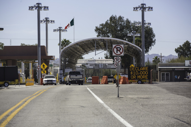
The Organ Pipe Cactus Monument is located just 5 miles north of Lukeville which is a small border crossing into Mexico. Not many services here; Fuel, limited food supplies, and post office.
ORGAN PIPE NATIONAL MONUMENT (516 square miles of Sonoran Desert)
We Finally made it to this beautiful National Monument and had over a week to stay and explore. This is the only place in the United States that these unusual cacti survive. The park was established by President Franklin D. Roosevelt in 1937 and has since been recognized as a Biosphere Reserve by the United Nations. Over 95% of the monument is designated wilderness.
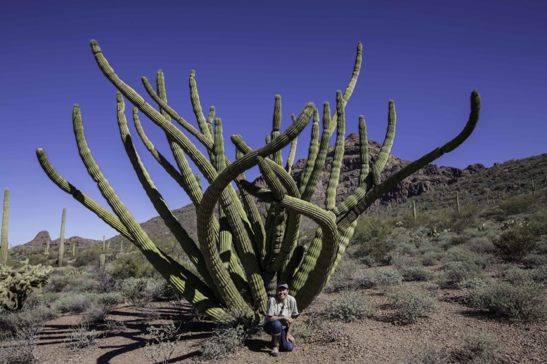
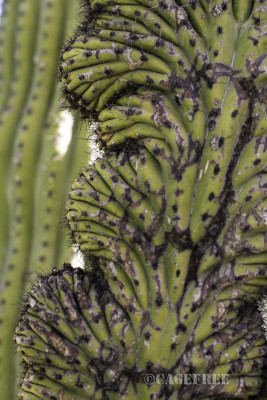
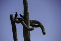
We found several specimens that were crested (an abnormal growth) which gives them a beautiful look. The above photo, is one of the more spectacular crested arms that we encountered on one of hikes and drives.
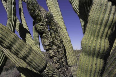
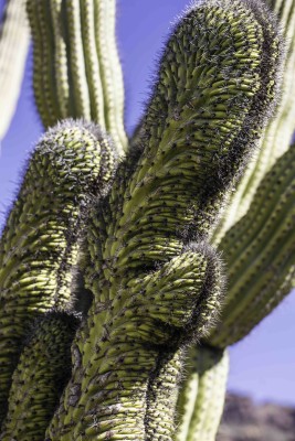
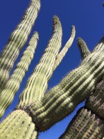
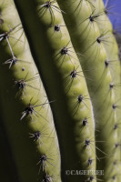
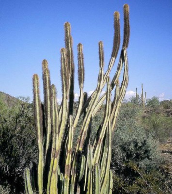
The Organ Pipe Cactus grow abundantly in this part of the Sonoran Desert and it’s common to see this species in Mexico. It grows on the warmer slopes and is accustomed to infrequent rainfall and abundant sunshine. It cannot tollerate severe frost but can easily handle air temperatures in summer that can soar to 118 degrees. It has lavender and white flowers that bloom May to July. I doubt we will ever observe the bloom because being in the Sonoran Desert in midsummer is not on my must-do list.
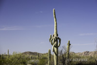
Of course you will also see many saguaro cacti as well.
Another species is the Senita cactus; especially abundant in Senita Basin and on the trails in that area.
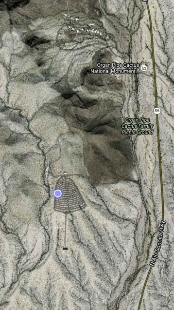
A map of the monument can be found here. Map
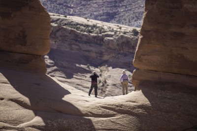
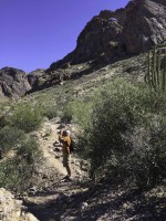
We hiked many of the trails in the monument but the most grueling for me was the Arch Trail. This trailhead is off the Ajo Mountain Drive. Yes it has some very steep solid rock areas but the main glitch was the fact that we set out on the trail at 12:30 in the afternoon. How do you spell Stupid! Then after hiking beyond the main part of the trail to the top we found we could never actually reach the arch. The upper part of the trail becomes very steep and smooth granite.
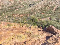
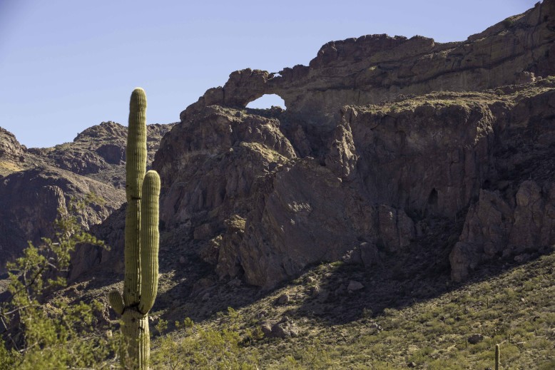
Our best view of the arches actually were from the road 1/4 miles before the trail head. This road by the way, is one way, so if you miss this view, you would have to come back another day and hit that road again. This particular loop drive is 21 miles so not something you can just re-do easily.
Here is a closeup of the two arches.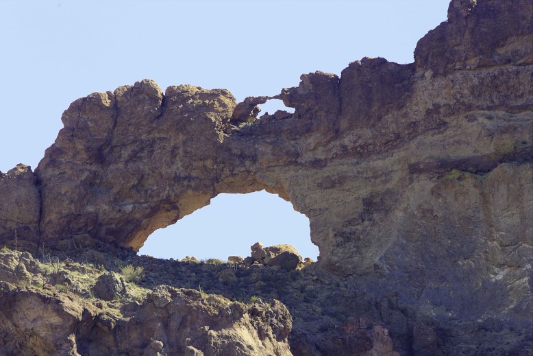
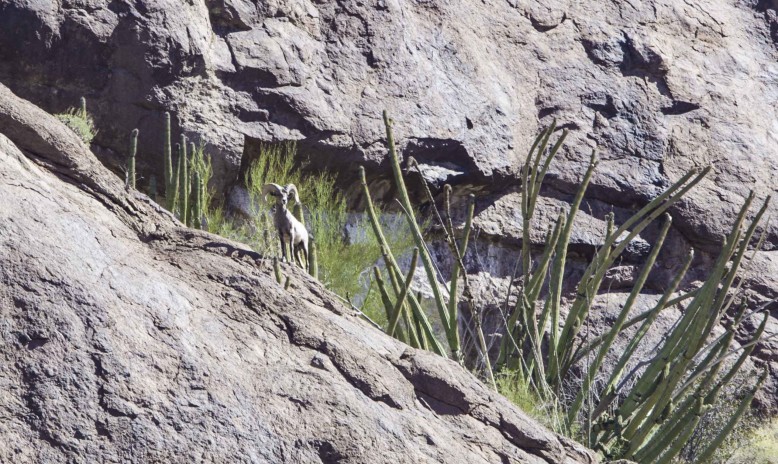
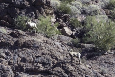
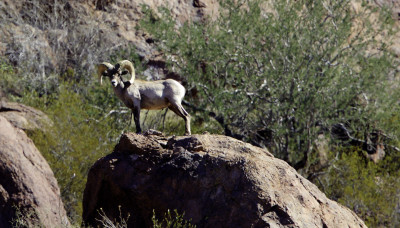
This is very rugged country and we felt we really should be seeing some Desert Bighorns along the way. We were not disappointed when we spotted not one but four of these beauties. They were a long way up the hillside just tiptoeing around the steep rocky areas, out of reach of my lens. It was a great experience to see them all nevertheless.
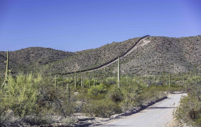
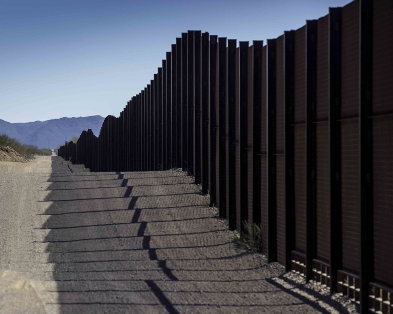
At the opposite side of the monument is the drive to Quitobaquito Spring. Take the Puerto Blanco South drive along the border fence. If you are interested in some of the history of the fence check out this link The Border Fence History.
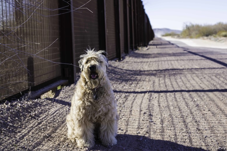
My Border Patrol Dog!
Quitobaquito Spring
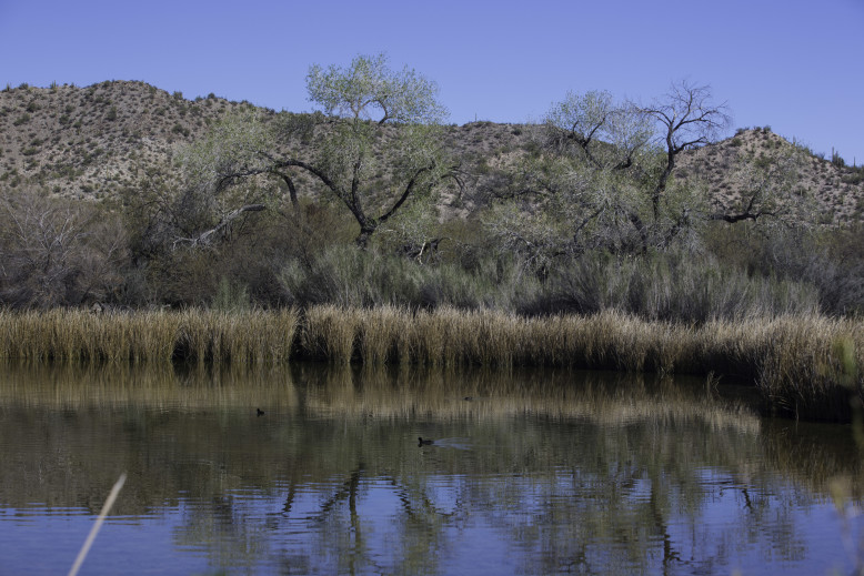
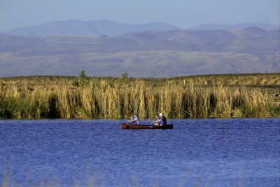
A true Oasis in the Sonoran Desert, Quitobaquito Spring is one of the few sources of water in the monument.
One thing to take into consideration when you visit the monument, especially as you get closer to the border, is to check your cell phone to make sure your phone is not receiving a signal from a Mexico carrier. This could cause you some unexpected charges.

Here is a Google Earth view of the Twin Peaks Campground at Organ Pipe Cactus National Monument. The campground does not take reservations, it’s a first arrive basis. They have restrooms/showers and garbage services but no water or power at the sites. Generator hours are very strict, in winter you have two specific hours in the am and two in the afternoon to run a generator.
Each night there is a Ranger presentation at the amphitheater, all at very interesting.
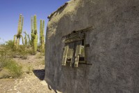
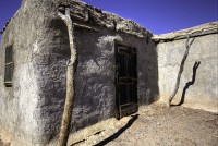
We took all the jeep roads and many of the trails during our visit. The North Puerto Blanco Drive, and the drive to both Gachado Line camp and Dos Lomitias Ranch. Both of these are found on the Eastern turn off Highway 86 to Camino de Dos Republicas.
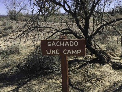
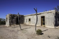
One of the camps once run by the Gray family of ranchers.
There is a great deal of information and reports of the many years of this family running cattle through the area. The desert is still trying to heal from the 50 years of over grazing. The History of Ranching
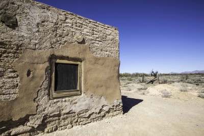
A second ranch in this area is called Dos Lomitios Ranch (Blankenship Well) Its a very picturesque building.
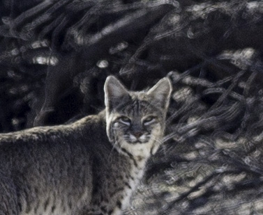
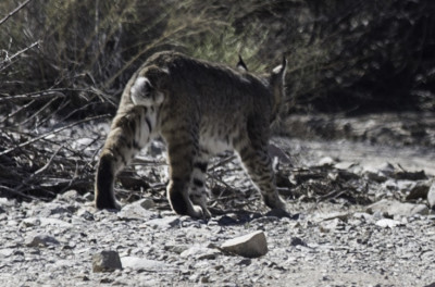
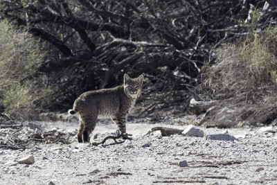
Along the Quitobaquito trail there is a likely chance to see wildlife since this is the only water source for many miles. This Bobcat was walking through the bushes. I walked quickly to a large wash where I had hoped she would appear. When she did, I had to make some cat like noises to get her to even look at me. Just a beautiful animal.
There are two interesting trails into the Ajo mountains. One is Estes Canyon and the other is Bull Pasture. The trail is roughly a 3.5 mile loop and over 1000 foot elevation gain so certainly these trails, like most in the Sonoran Desert, are best taken earlier in the day. The view from the top is beautiful.
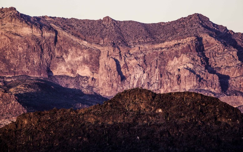
One thing I learned on one of the ranger led tours was about the rock formation in this area. Of course you cannot see it when you are on the trail but from a distance, near the visitor center or at the Gachado Line Camp; if you look back to the Ajo mountains you can see the outline of a long horn steer. Especially at sunset the pink granite provides a distinctive outline of the steer, pictured below. After several attempts, the sunset finally lit up the mountain for me to capture the picture.
Moving on now toward Tucson. It’s time to restock food and fuel supplies.