After leaving Bisbee we wanted to stop somewhere a few days to let the weather clear up in Utah where we planned to go next. I found a listing for a State Park near Safford, Arizona. I was skeptical about this park but it fit our schedule and a place to hang out for a few days in the warm Arizona sun.
ROPER LAKE State Park Stafford Arizona is on highway 191 south of Safford about 8 miles.
We were pleasantly surprised. Many species of birds called this place home while others were likely just on a stop over heading north. We found this park to have more birds than we saw in any of the Wildlife areas we visited nearby.
Osprey, many Duck Species, Gamble’s Quail, Herons and my favorite were the Yellow headed Blackbird. I love their croaking raspy notes. There were huge flocks of these birds here.
Click for larger images:


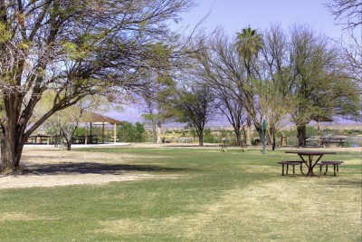
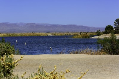
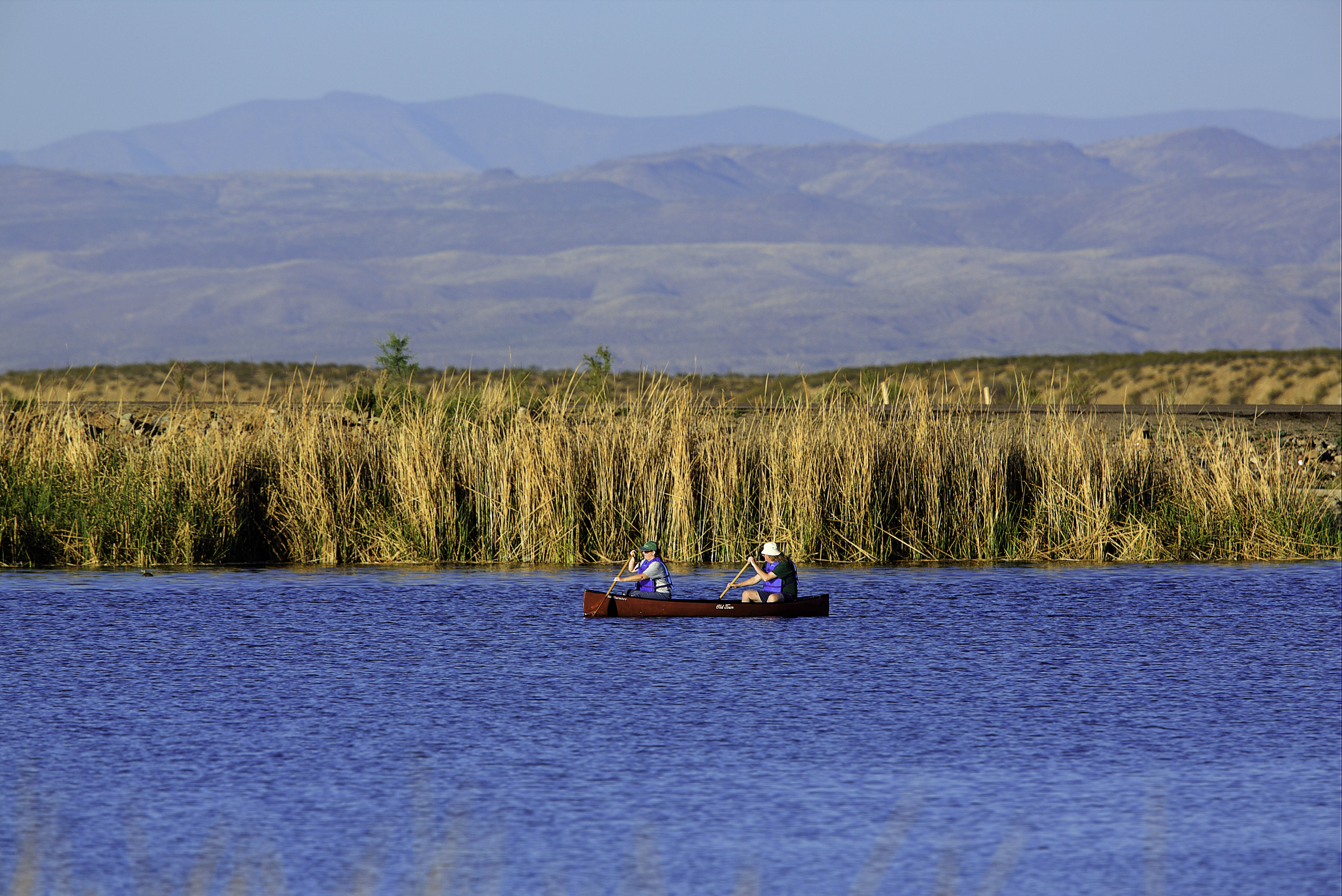
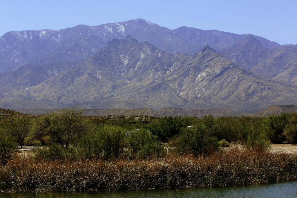
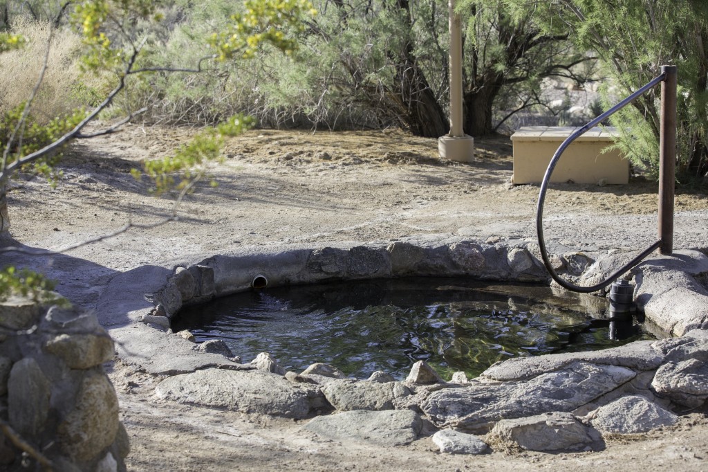
The lake is about 30 acres in size. There’s a boat ramp to launch small boats with electric motors only or of course your kayak or canoe. Fishing, Birdwatching,bicycling. There is a nice enclosed dog park and the whole park is very well kept. There is a Hot Springs here at the park. An enjoyable way to relax you muscles after a day of biking or hiking.
We made day trips to many of the suggested wildlife areas during our stay here.
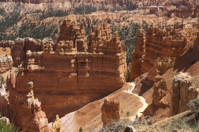
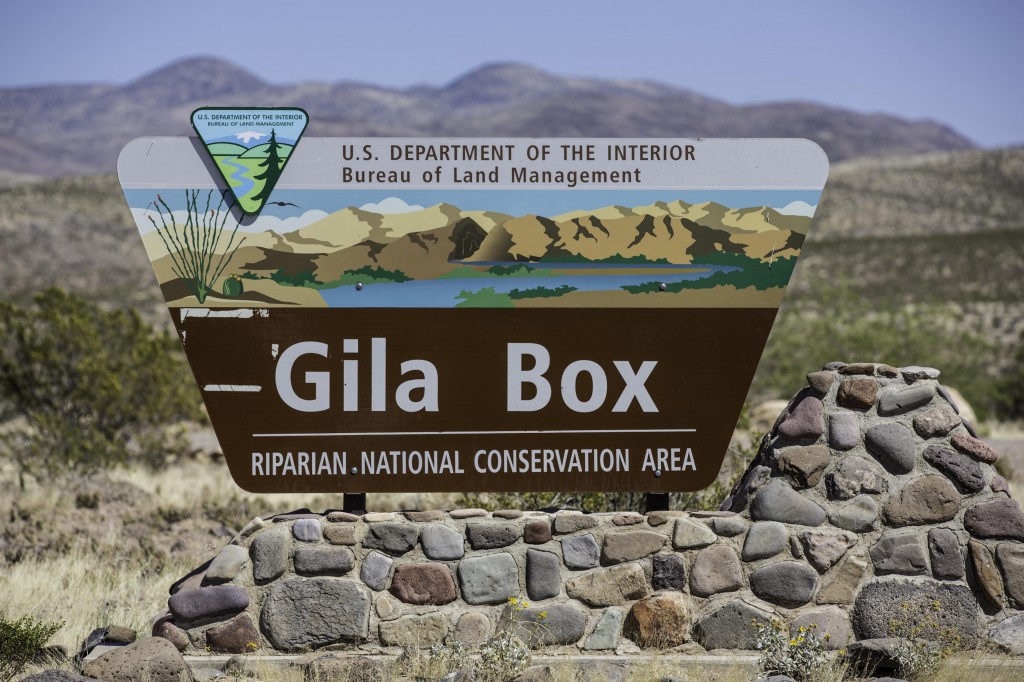
The first trip took us to the Gila Box Riparian National Conservation area which is several miles to the north of Safford. This area consists of two distinct canyons.
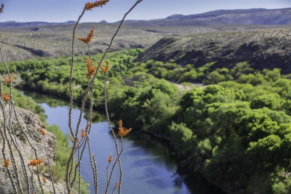
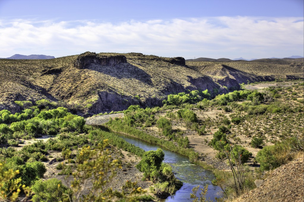
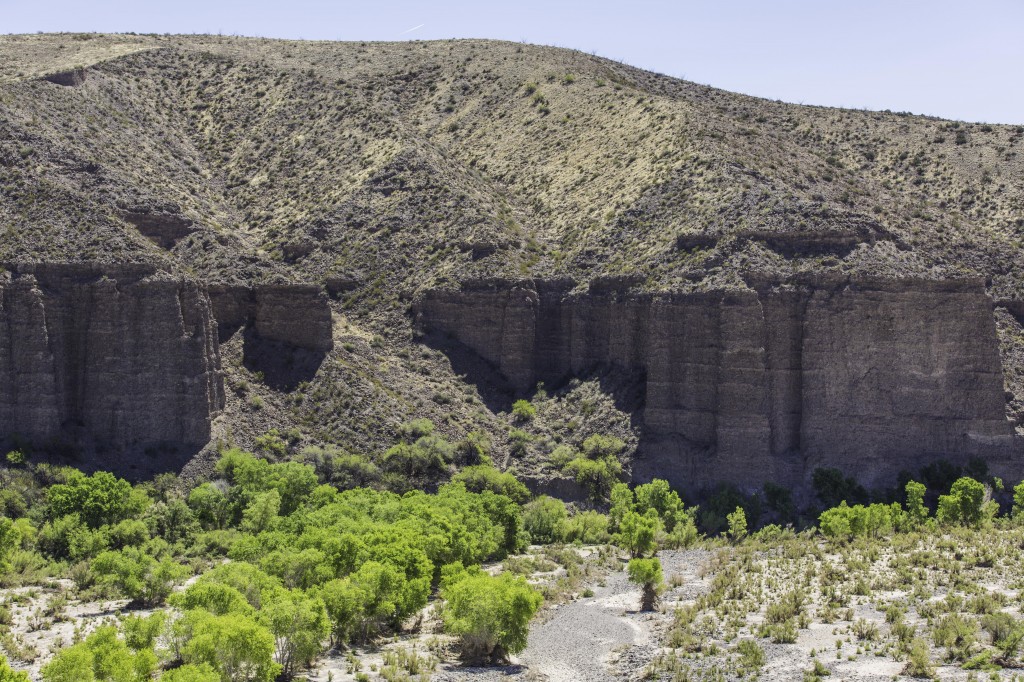
BONITA CREEK has scattered strands of large cottonwood, sycamore, walnut, and mesquite trees. It’s such a contrast to see the ribbons of green from the trees at a distance with all the dry desert for miles surrounding it. Its quite a deep canyon with rugged cliffs lining some of the stretches of the creek. They say over 140 species of birds, including the yellow-billed Cuckoo have been recorded in this area. With the exception of a few hawks, I was disappointed there were so many no shows for that day.
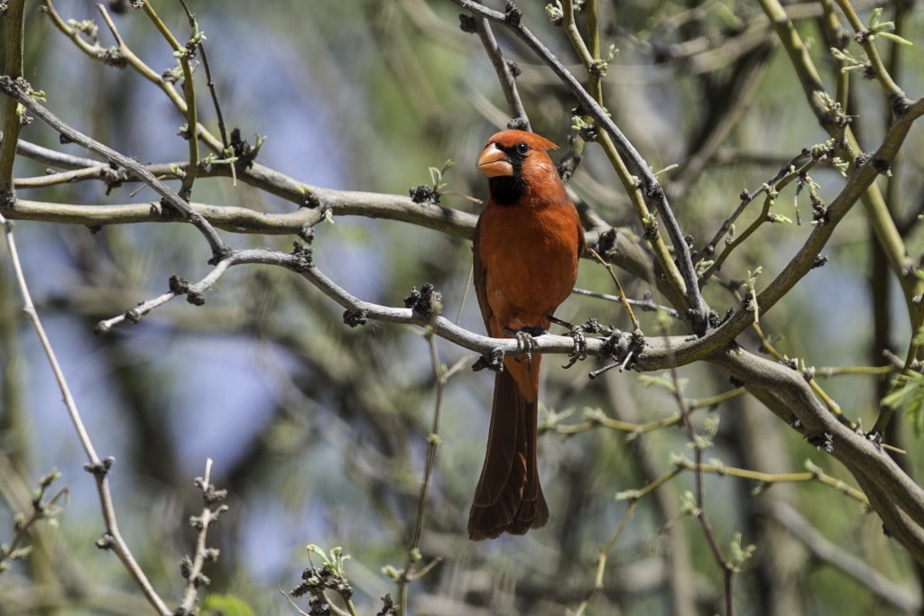
Near the confluence of Bonita Creek and the Gila River you will find a parking lot and a trail leading up the west side of Bonita creek. A few benches along the trail with occasional information plaques telling about the birds, animals and plants in this area. Built on the edge of the creek just above the tree canopy there is a nice covered ramada with benches. It was called a “Watchable Wildlife Viewing Deck” We had our picnic lunch here and quietly waited for the wildlife to appear. I chose a few bird calls from my iBird App but the only birds that answered me or seemed mildly interested were the cardinals. We didn’t think this was the appropriate spot for Mark to use his “wounded rabbit call” since there was much written about the Mountain Lion living in this neck of the woods. We thought we’d get more than a shy coyote strolling by.
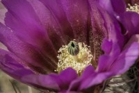
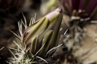
Flowers in the desert are always and eyecatcher, especially for a photographer. Such dry barren land & here are such beautiful gems popping up from totally dry land.
Click to enlarge:


The rest of the trip we followed the jeep roads for miles, occasionally stopping at the GILA RIVER to take in the sounds of the birds and the clear water flowing through the canyon.
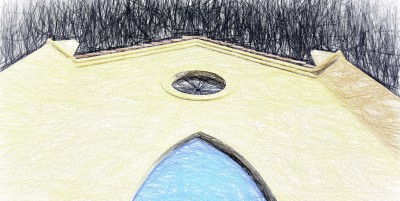
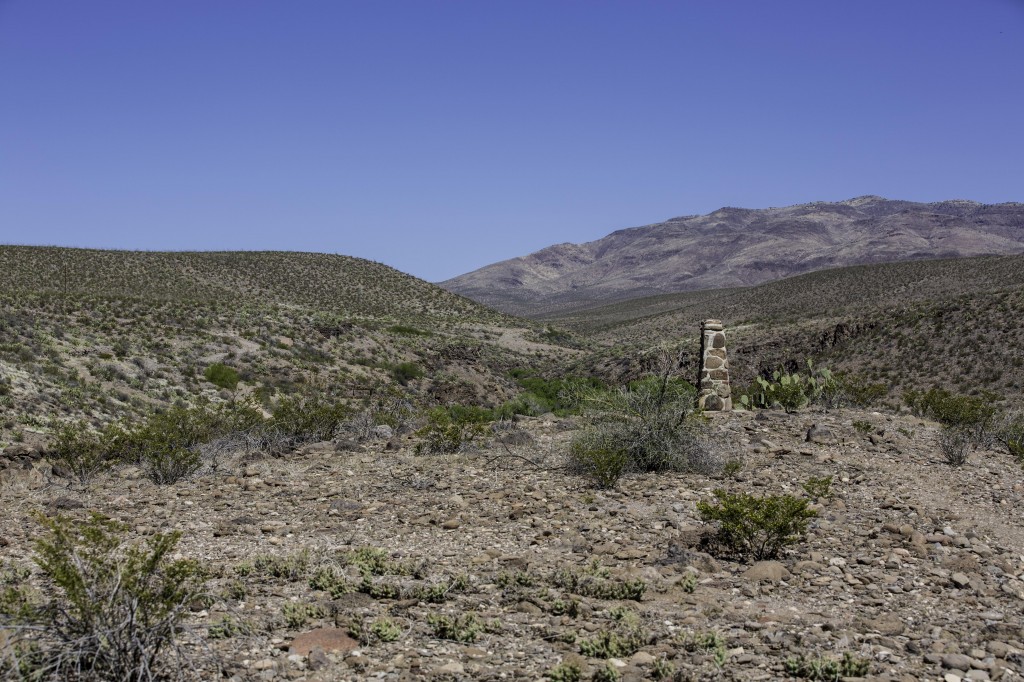
Just above Bonita Creek along a trail, I came upon this stone plaque.
Cluff Ranch Wildlife area was listed on the brochure.. Don’t bother with this one.
SWIFT TRAIL. This is a Very scenic drive in the Coronado National Forest. You’ll travel up the eastern and then southern banks of Mt. Graham. From 3300’ to around 8800’ in about 18 – 20 miles. Be prepared for about a 30 degree temperature drop at the top. Absolutely breathtaking views of the valleys below. Beginning with cactus and Ocotillo fields and ending in pine and spruce forests. At the end of the road (Hwy 366), the pavement ends but you can continue another 12 miles on a dirt road to Riggs Lake. The Upper road is closed Oct to Mid-April. The round trip takes about 5 hours.
If you are camped at Roper State Park, your camping pass will admit you to the nearby Dankworth Pond, 7 miles south of Roper Lake. It’s part of the AZ State Park system. The pond is home to Pelicans, Black-crowned Night-Herons and others. There are a few trails leading through the cattails and mesquite trees where there are plenty of other birds to look at and photograph. The one day we visited, it was too windy for photographs.
We would have stayed longer at Roper Lake but the Whole park was reserved for the Girl Scout Jubilee beginning Friday for the weekend. We would camp here again sometime.
The route we took from Roper Lake was Hwy 70 up to Globe and then North on 77/60 toward Show Low. Between these two towns we traveled through some of the most amazing mountains and canyons. Steep 6% grades up and down. The drop down into the Salt River Canyon was a “puckering” experience. So beautiful at the bottom, the river was awesome. Unfortunately the pull offs were filled with motorcycles groups and other rvs and we just have to keep going. The only pictures I could get were from the front window of the motorhome..

It was pretty chilly in Show Low and although we really want to spend some time there, we decided we wanted to head toward southern Utah or pop over to Mesa Verde National Park. So we continued up 77 to Holbrook , Arizona for an overnight.
Today we woke up and completely changed our decision about heading straight to Canyonlands NP. We decided to head to Mesa Verde NP. Yes it is early in the season and many of the tours will not be available, but we are this close and don’t know when we might get here again. We plan to stay in Cortez, Colorado and 20 miles northwest is Canyons of the Ancients National Monument. It will be a brief visit to these two areas but hopefully we will get back here again.
Our main upcoming focus will be Canyonlands and Arches National Park for a couple of weeks. So if the weather holds out for us I plan to have some nice pictures of these two very popular National Parks.
So Off to Cortez, Colorado today.