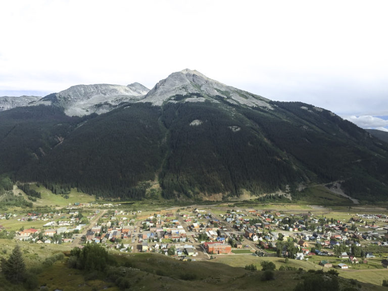
After reading about the history of the road from Ouray to Silverton, we decided to follow the original wagon trail in our Jeep that was built in 1883 by Otto Mears, born 1841 in Russia. He traveled to San Francisco as an orphan and worked in California’s goldfields. He served in the Civil war and also served under Kit Carson in the Navajo campaigns. He was discharged from the Army in New Mexico and soon became a successful road builder in Southern Colorado. The route we will take today was actually a toll road from Ouray to Ironton, up through the Uncompahgre Gorge. The toll booth was located at Bear Creek Falls charging $5.00 for each wagon team. In 1887 Mears founded the Silverton Railroad Co. He built tracks from Silverton up Cement Creek to Red Mountain Town and on to Ironton along the route of the toll road he had previously made. An engineer named C.W. Gibbs built a turntable covered with a snow shed and approach tracks at Corkscrew Gulch. (Elevation 10,355) This incredible design solved the problem of how the train could make the switchback turn, to head down to Ironton and RedMountain Town. You can see some interesting pictures of the remains of the mining camps and this ingenious turntable taken by a train buff named Glen Brewer, located here http://railroadglorydays.com/Corkscrew/ The road no longer follows Cement Creek and over Corkscrew Gulch. It now continues from beyond Ironton down to the Ghost town of Chattanooga and on to Silverton. A transformation into what is now called Highway 550, “The Million Dollar Highway”. Otto Mears built over 450 miles of roads during his time in Colorado. He died in Petaluma, California in 1931.
So… off we go at 8:00 AM, to Silverton the Hard Way.
In order to reach Red Mountain we took Corkscrew Gulch up toward Hurricane Pass and then down Cement Creek to Silverton.
To get to Corkscrew Pass, you travel up Highway 550 toward Red Mountain. At Ironton Park, eight miles south of Ouray turn to the left, and you will see the staging area. This trail is rated Class 3 (Difficult) which is two classes less than the most difficult or Expert. (Experts we are not) It had been raining every afternoon for several days, so the trail was muddy, and the rocks were slick. I would say that the worst part about this trail is the oncoming traffic on basically a one-lane Jeep trail.. and the fact we were on the cliff side of the road. The day we went, it was BUSY in both directions.
The views going to the summit were amazing. The many shades of Red, Purple, Green and White were incredibly beautiful. The pictures tell the story of this trail better than I. For obvious reasons, I didn’t take pictures during the rough part of the climb.
Stunning photos. Great blog post.
Thanks, Gisela!
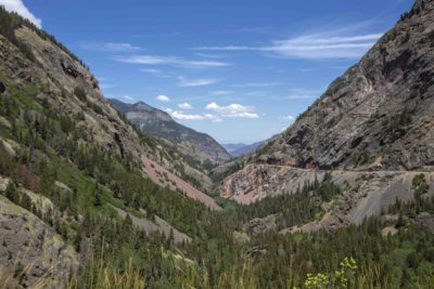
Love the photos especially the summit photo at 12,000 feet! What an exciting 4×4 drive that should be on our bucket list. Continue to enjoy your visit to Switzerland.
Thanks, David, Colorado has quickly become one of our favorite states. We will return when we have at least a month to spend.