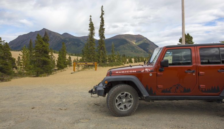
We had intended to stop in Carcross on our way North and missed the turnoff. So this time we arrived with the intention of seeing the local art and then taking a day to drive to Skagway.
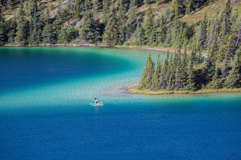
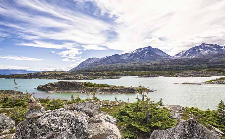
There’s More spectacular scenery along the Klondike Highway. Emerald Lake, The Jewel of the Yukon. Its spectacular colors are the result of the light reflecting off the layer of marl (a mixture of calcium carbonate and clay) at the bottom of the lake.
ARRIVING IN CARCROSS
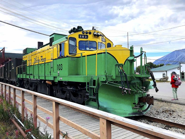
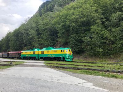
Carcross is a small village Population 500+ It’s the northernly stop on the White Pass railroad that travels round trip to Skagway.
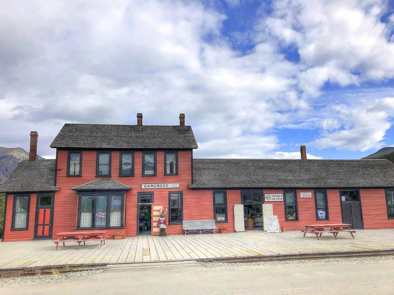
The original station burned down in 1910.
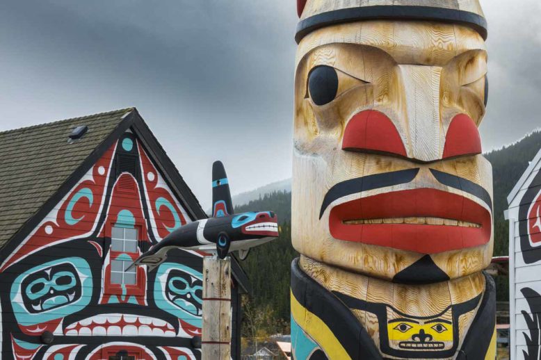
At the train station, there are shops with locally made art. It seems some of the shops are selective as to when they open. If there is a bus or train in town they are usually open. The museum is small but has two interesting videos of the history of the area. This little area is called Carcross Commons.
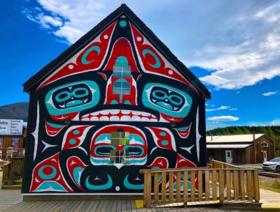
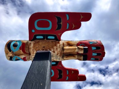
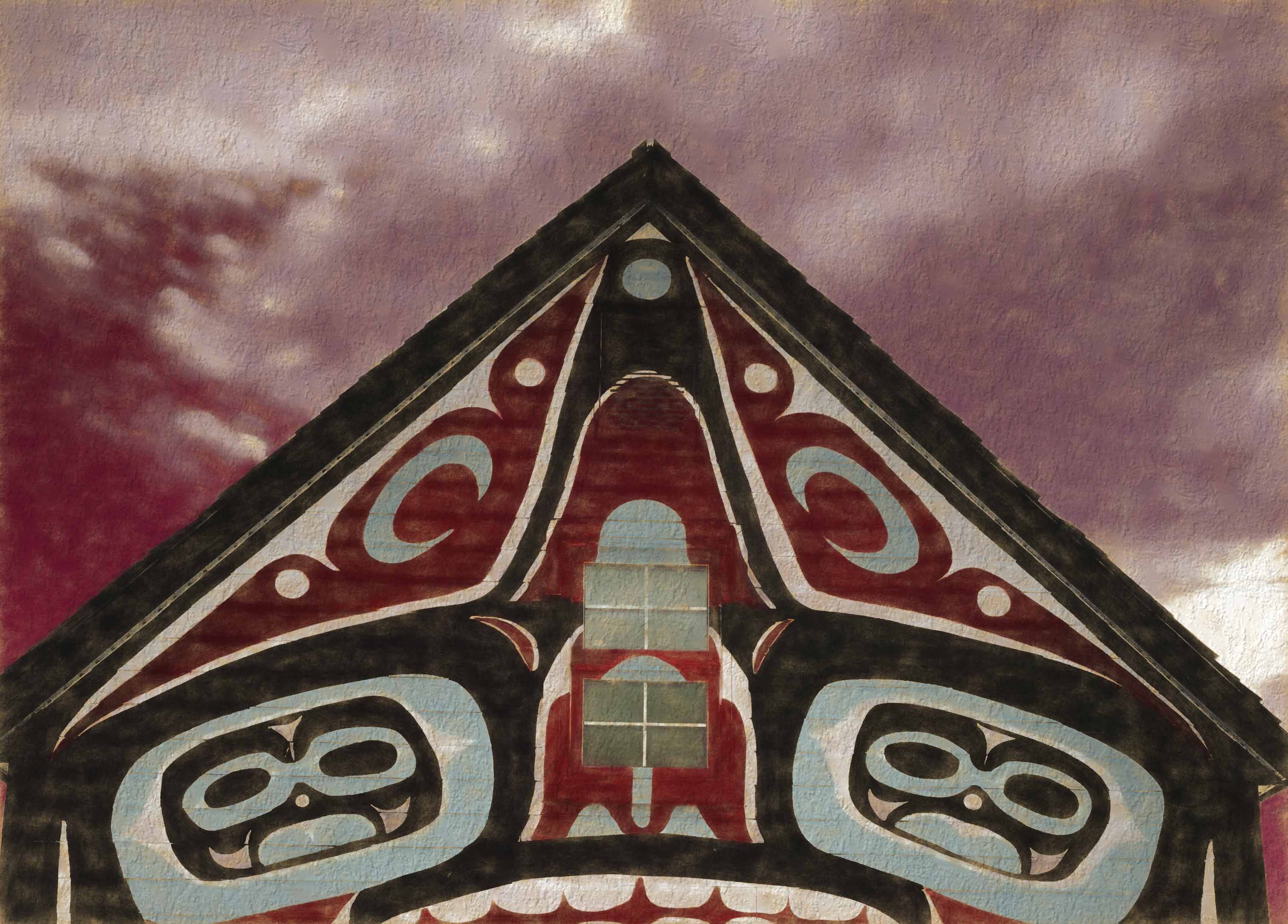
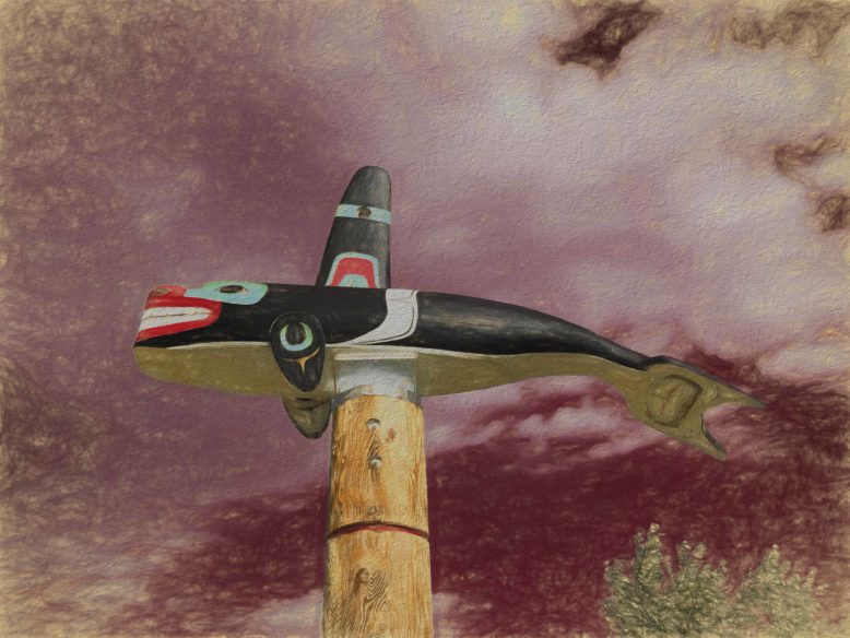
This community was once known as Caribou Crossing. The Tlingit (pronounced Klinkit) Tagish First Nation peoples settled here. They intermarried and later the Tagish language became extinct. The Tlingit people were from the coastal area and the Tagish were from inland areas around Marsh Lake in the Yukon. Their art is quite beautiful.
Be sure to check out the Carving Shed. This is where much of the local carving is done. The head carver is Keith Wolfe Smarch born into the Killer Whale Clan of the Tlingit Nation in 1961. It’s worth taking the time to see him and his work in action if he is in the workshop. His work has been exhibited worldwide and a prominent piece can found in the Prince of Wales’ private collection.
Check out this YouTube video of him and his work if you are interested.
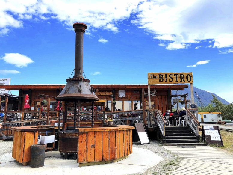
HUNGRY? have a great lunch or breakfast at The Bistro. Homemade specialties include delicious salads, & fresh halibut and salmon specials. They also had “Poutine”. We’ve seen it on the menu all over Canada and Alaska but never ordered it. We were told by one of our RV friends that the Poutine here was the best. So we shared an order to determine if we like this local favorite. Up til now, we had avoided it. If it’s new to you, It is a plate of French Fries cooked crispy with a dark gravy and cheese curds over the top. I’d call it Northern style Nachos. We ate it but I probably would not order again. It’s not diet food!
The Worlds Smallest Desert
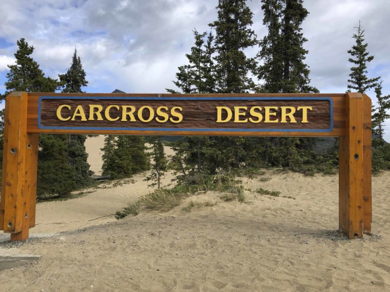
This area once formed the bottom of a glacial lake. The sand and silt was deposited into the ancient Lake Watson 10,000 years ago. (how do they know these things) This unique and fragile ecosystem is home to many rare plants and animals that are not found many other places in the world.
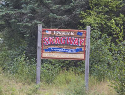
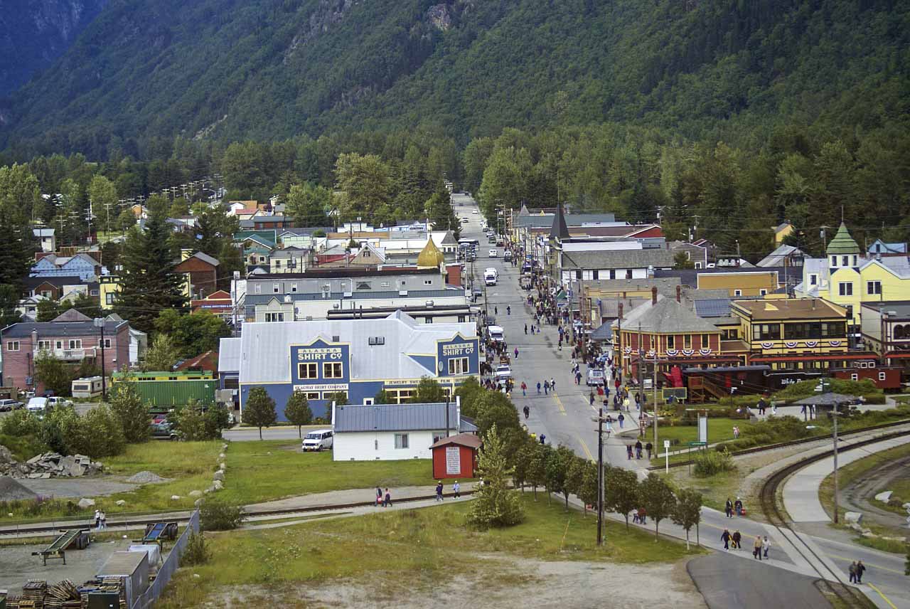
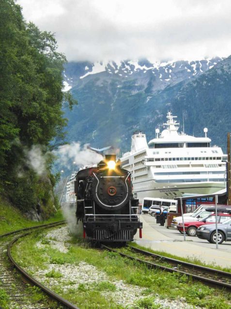
Wet weather was coming in the next day, of course, but it was our only day to travel to Skagway. It too was a spectacular drive on the South Klondike Highway. When we got up in elevation, however, the clouds were so low to the ground we could no longer see more than a car length in front of us. Bus after bus was coming up the grade like a parade. We were warned of the crowds that could be in Skagway when the cruise ships are in. Then the busses take passengers up to Whitehorse or for a side trip to Carcross. We made it to Skagway and wow what craziness.
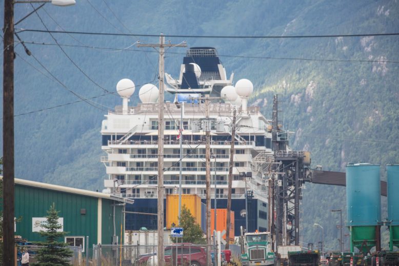
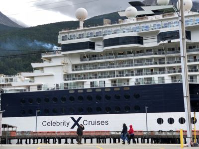
There were three cruise ship in port today.
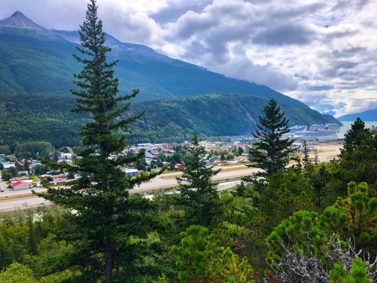
People are everywhere, the sidewalks are overflowing. We found a spot to park the jeep and we walked around town a bit and found a restaurant for a Mexican lunch.
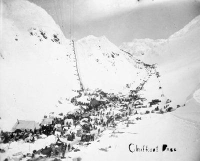
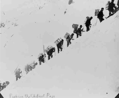
After a few spins around the town we headed out Dyea Road, It was a fairly smooth winding dirt road most of the way as it followed along the Taiya Inlet. It ended in Dyea Flats which is where the townsite once was. Over 8000 people, 150 businesses from Attorneys to undertakers settled here at the height of the gold rush. Now it is just a marshy flat with little indication of a town. A few of the pilings are still visible in low tide. This was the beginning of the Chilkoot Trail where gold seekers made their way to the Klondike gold fields.
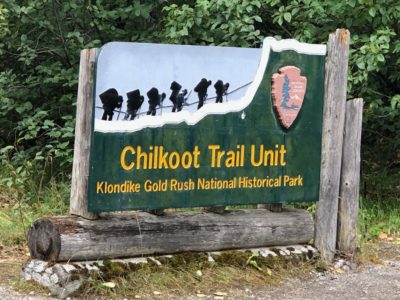
Not much to see these days in this area it’s just flat marshy ground but in 1896- 1899. Those gold seekers were determined to get to the Klondike Goldfields and this is a look of those days. A 33-mile trek up to Bennet (Bennet Lake) near Carcross and from there up to Dawson City.
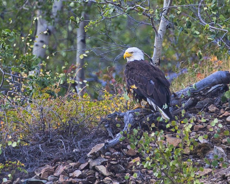
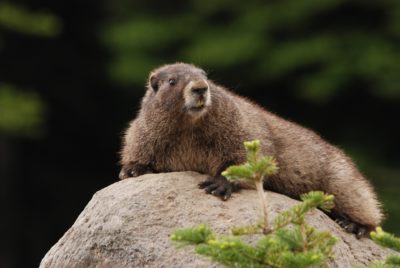
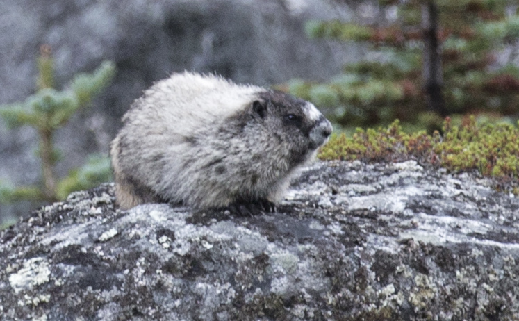
On the way back to Carcross we made several stops to have a look at the scenery, wildlife, and waterfalls.
The dramatic landscape of Tormented Valley high in the Yukon above Skagway is amazing. It truly looks like you have just arrived at Frodo Baggins’ homeland as I remember the vision I had as I read J.R.R. Tolkien’s trilogy.(more than once) The trees average 3 feet tall and the rocks and rises in the landscape are inches to a few feet tall. It’s very strange. I took a rock from Frodo’s front yard, I hope I won’t be forever under some sort of spell.
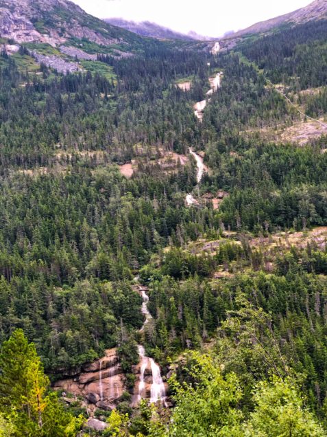
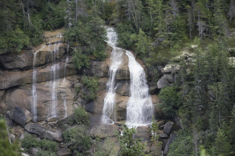
Reports list Pitchfork falls as 2100 feet in all placing it among several Wolrd’s Tallest .. But the jury is out as to whether it is in fact considered one waterfall. Well, It looked like one long waterfall to me and it was breathtaking but the camera refused to show the drama of it. Just 1/4 of the way up in the photo is where the railroad crosses the falls, just a little speck of a bridge. If you can enlarge this photo to see the train trestle, you will get a perspective of the size of this falls.
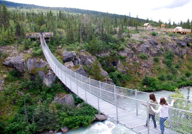
Along this route, you will pass the Yukon Suspension Bridge over the Tutshi River. It’s only 65 feet above the river below.
Further down the road, a couple of black bears caused a “Bear Bus Jam” along the highway south of Carcross Two or three tourist buses stopped in the road for a look at the bears. One bear ran in front of a motorcyclist which was a close call. Yes, I have one or two of those iPhone shots “from the motorhome” but don’t need to include it here, I’m sure you have the image in your head already.
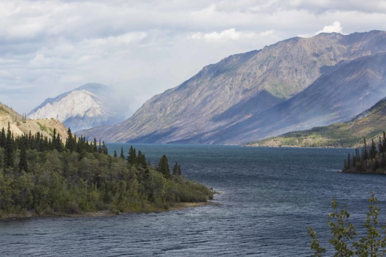
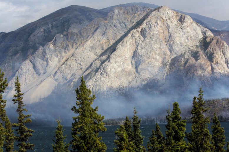
It was smokey from a fire across the canyon south of Carcross. The sign said Fire Management Area so perhaps that was what they call in the states “A Prescribed Burn”.
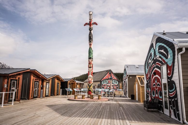
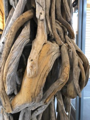
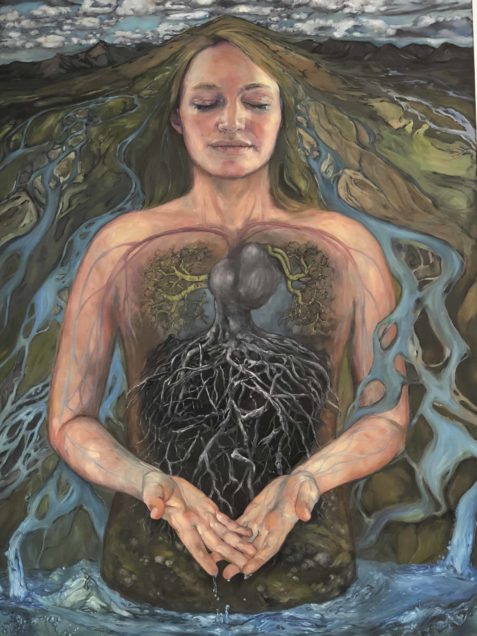
Before they closed, we made our way to the cultural center in Carcross. It’s located on the highway just before the bridge. Some of the most impressive sculptures we have seen lately were on display inside the center. They were made out of driftwood and put together like the bones and tendons of ancient peoples from the north. The sculptor, Suzanne Paleczny created them from wood she had been collecting.
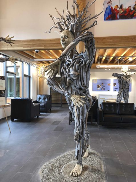
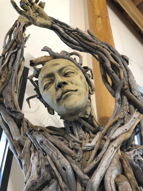
 She is also a fine art painter.
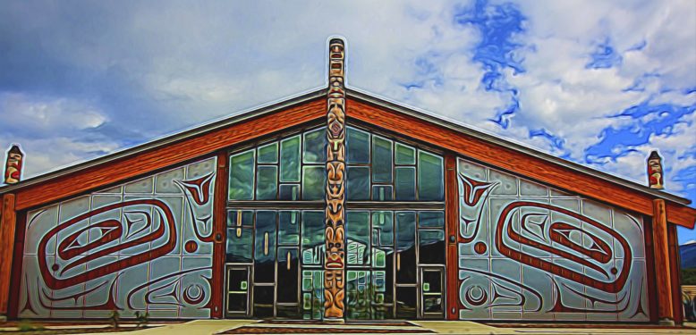
Totem poles are installed at the entrance to the exhibit and the largest building is beautifully designed with an overlay design of a typical native carving.
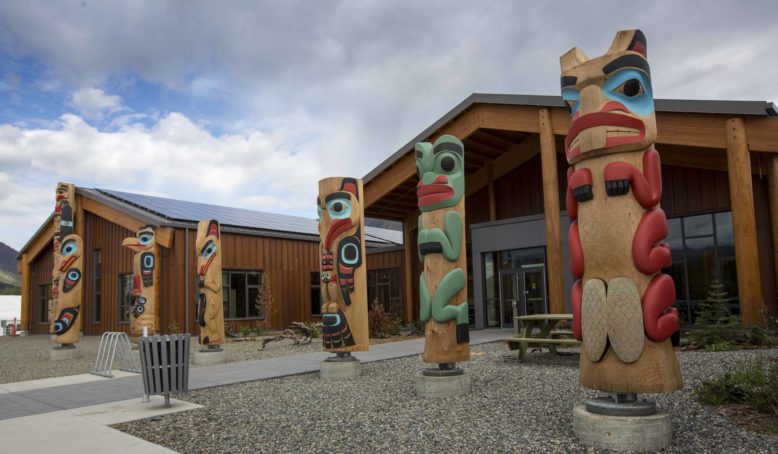

Spectacular!!!!